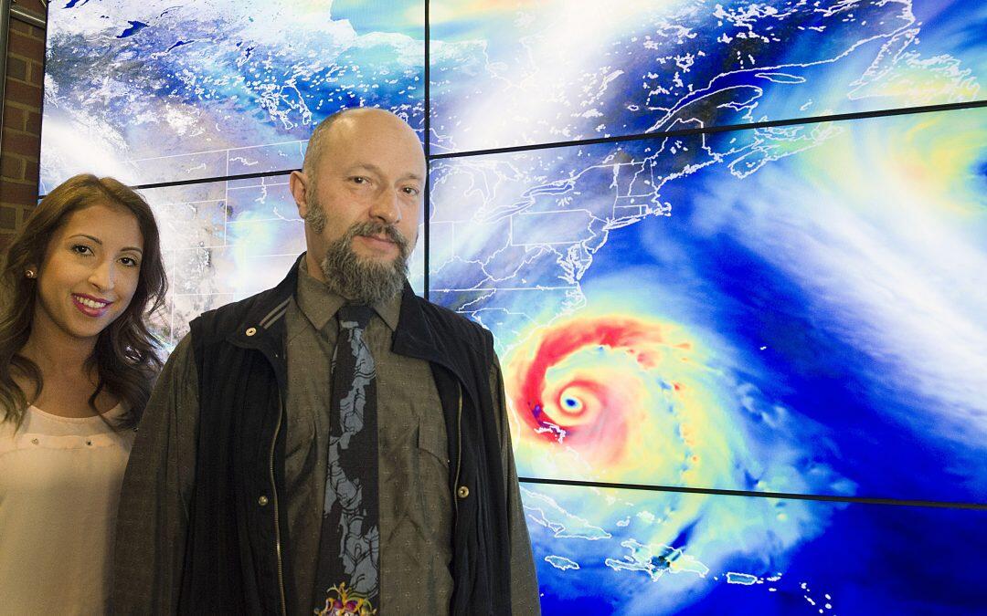
Every day, scientists at NASA work on creating better hurricanes – on a computer screen. At NASA’s Goddard Space Flight Center in Greenbelt, Maryland, a team of scientists spends its days incorporating millions of atmospheric observations, sophisticated graphic tools and lines of computer code to create computer models simulating the weather and climate conditions responsible for hurricanes. Scientists use these models to study the complex environment and structure of tropical storms and hurricanes.
Getting the simulations right has huge societal implications, which is why one Goddard scientist chose this line of work.
“Freshwater floods, often caused by hurricanes, are the number one cause of death by natural disasters in the world, even above earthquakes and volcanoes,” tropical meteorologist Oreste Reale with Goddard’s Global Modeling and Assimilation Office (GMAO) said. “Seeing how the research we do could have an impact on these things is very rewarding.”
Improved models can lead to better prediction and warning for these natural disasters, mitigating loss of life and property.
Getting to the point of being able to accurately study hurricanes using computer models, however, is not easy. Because hurricanes are such complex storm systems, capturing their full nature in detail using a computer simulation is far from simple.
“We need to add complexity all the time and nobody here is afraid of doing that,” Reale said. “You don’t want a simple solution. If it’s simple, chances are it’s not true.”
Adding complexity can include updating the models, incorporating data from new satellites, replacing old satellites and more.
Reale and his colleague, Goddard tropical meteorologist Marangelly Fuentes, have more than 25 years’ combined experience looking at modeled storms. In fact, Fuentes was Reale’s student intern while she was earning her doctorate degree at Howard University in Washington, D.C. They belong to a team in the GMAO whose goal is to assess whether new data types are used efficiently in computer models, and to ensure that changes and updates improve the performance of models and their data assimilation systems compared to previous versions. Data assimilation refers to the process through which data or observations are incorporated into an existing model.
“Mostly I look at tropical forecasting and the analysis of tropical cyclones in the models, so we monitor how the different models are performing with tropical storms,” Fuentes said.
This includes comparing the performance of GMAO’s weather and climate models with others in the U.S. and around the world. Fuentes looks at current versions of the GMAO model and compares them with newer, updated versions in development. By comparing the results of newer simulations on past, well-known storms, she can verify if the updated model version will be more effective at predicting the track and intensity of future storms.
“We are able to use cases like Hurricane Katrina to run tests and show us how we can improve, or how this new change affected the forecast or the analysis of the storm system,” Fuentes said.
The closer the results are to the actual behavior of the storm, the more accurate the model.
Fuentes has worked extensively on the intensity prediction of Hurricane Katrina. Weather models in 2005 – the year Katrina struck the Gulf Coast with devastating results – predicted that the storm’s pressure would reach as low as 955 millibars, significantly underestimating how low Katrina’s atmospheric pressure would get, and therefore the storm’s intensity. Observed data show that pressure in Hurricane Katrina’s eye reached a minimum of 902 millibars, one of the 10 lowest pressure readings on record for an Atlantic hurricane. The most modern model produced by the GMAO, which Fuentes has been analyzing, can produce a model of Katrina’s pressure much closer to the actual observed levels from 2005.
Changes to these predictions are caused by improvements in data assimilation and model resolution, made possible by increased computer processing power. Improving the resolution of the model works similarly to increasing the resolution of a photo. The more pixels, or dots of color, in a square inch of a photo, the higher the resolution. High-resolution photos appear sharper and capture more detail than their low-resolution counterparts. Likewise, higher-resolution models produce more detailed simulations of hurricanes, giving researchers a better understanding of their behavior.
“In the model we basically transform Earth’s atmosphere into little ‘cubes’ and in each cube the fundamental equations controlling motion, energy and continuity of the atmosphere are solved,” Reale said. “The smaller the size of the cube, the more realistic the representation of the atmosphere.”
Reale said that high model resolution is a critical factor in capturing hurricanes accurately. Luckily, there has been much improvement to model resolution in the past 10 years.
In 2005, the record year of 27 named tropical storms or hurricanes in the Atlantic, the size of the “cubes” in GMAO’s model was about 31 miles (50 km). Today, the resolution is three to four times higher at about 8 miles (12.5 km), giving scientists a much clearer and more detailed look at the state of the atmosphere.
Of course, Reale said, there’s still work to be done. “There’s no such thing as perfect in research and science, but there is certainly a big improvement for the intensity that contemporary models could predict if they had to face a situation like that again,” he said.
Reale believes this is the team to do it. “I feel that I’m part of an organization that is extremely successful in facing many different aspects of science,” he said. “There are people from all over the world, and I’m sure that whatever question or issue I may have, there’s someone who knows the answer in this building. I can tap into the knowledge and experience of so many people.”
Fuentes and Reale are part of the GMAO, which consists of more than 150 people, all working on different aspects of the Earth-atmosphere-ocean-ice system. NASA collaborates closely with the National Oceanic and Atmospheric Administration, the agency that releases official forecasts to the public, to improve our understanding of hurricanes. Reale is also the principal investigator on a funded NASA project to improve hurricane intensity prediction through a better use of data from the Atmospheric Infrared Sounder (AIRS) onboard the NASA Aqua satellite.


