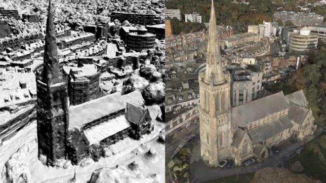
Next-generation smartphones could avoid signal drop-outs thanks to new data-rich maps being produced by Ordnance Survey.
The detailed 3D models feature buildings, proposed constructions, hills, trees and weather cycles, all of which can interfere with 5G signals.
Researchers will be able to test towers in various locations and instantly see how well they might perform.
One analyst said the tool would help networks provide better coverage.
Next-generation 5G networks will offer consumers faster connections and increased bandwidth for activities such as video streaming.
But Ordnance Survey says the higher frequency signals have a shorter range than current 3G and 4G signals, and are more susceptible to interference from “even raindrops and leaves”.
The planning tool will use Ordnance Survey’s mapping data and high-resolution aerial images to produce its 3D models, while weather data will be provided by the Met Office.
“The character of 5G means the location of cell towers is more sensitive – so it will be very important to fully understand the topography of each area,” said Ben Wood, analyst at CCS Insight.
“The better the tools networks have to help site cell towers correctly, the more likely we’ll get high quality coverage from the get-go.”
Ordnance Survey said its maps were so detailed, they even included vegetation cycles to determine how trees might affect 5G coverage during different seasons.
Parts of Bournemouth have already been modelled using the experimental tool, which Ordnance Survey hopes will be rolled out across the UK.
“It will be a useful tool for companies deploying 5G networks,” said Mr Wood. “But there is no alternative to spending the money to install a lot of cell sites.”


